What Every Builder and Developer Needs to Know
There’s a moment on every construction site, usually just before the first sod is turned or the first slab is poured, where the entire success of the project hinges on one thing: accuracy. Not close enough. Not roughly right. Accurate. And that’s where a qualified construction surveyor earns their place on the team.
Whether you’re a builder putting up a residential duplex in Brisbane’s inner suburbs, a civil contractor delivering a road corridor through regional Queensland, or a commercial developer managing a multi-storey mixed-use development, surveying is woven through every critical stage. It’s not an afterthought, and it’s definitely not something to shoehorn in once the design is done. Getting your surveying right from the beginning is one of the most cost-effective decisions you can make.
What Does a Surveyor Actually Do on a Construction Project?
It’s a fair question, because the role of a construction surveyor extends well beyond planting pegs in the ground. The reality is that surveyors are involved from well before the first contractor arrives on site right through to final handover documentation.
At Leading Surveys, we work across the full project lifecycle, from initial site establishment and control surveys, through to building and civil setout, quantity verification, and as-constructed documentation. Let’s break down what that actually looks like in practice.
Stage 1: Before Construction Begins, Site Establishment and Design Data
Before any design work can be finalised, the site needs to be properly understood. That means capturing accurate topographical data: ground levels, existing structures, services, drainage features, vegetation, access points and boundary positions.
A Detail Survey (also called a feature survey or topographic survey) does exactly this. It gives architects, engineers and town planners the reliable spatial data they need to develop a design that’s actually buildable. Without it, you’re designing into assumptions, and assumptions cost money when they don’t match reality.
Alongside that, Contour Surveys map the elevation and shape of the land. On sloped or complex sites, this information drives earthworks planning, stormwater design, cut-and-fill calculations, and retaining wall requirements. Get the contour data wrong and you can blow your civil budget before you’ve even started building.
Once the boundaries of the site are confirmed, through an Identification Survey or Boundary Surveys, the project team can work with certainty about exactly where the property starts and ends. This matters enormously for setback compliance, easements, and anything built close to a boundary line.
Stage 2: Site Establishment and Control Surveys
Once construction is ready to commence, the surveyor establishes the site control network. Think of this as the spatial backbone of the entire project. All subsequent setout and verification work is anchored to these control points.
Control surveys involve placing permanent survey marks across the site at precise, coordinated positions. From these marks, everything else is referenced: the building footprint, infrastructure alignments, road centrelines, pile positions, column grids, you name it. If those control points are poorly established, every piece of work tied to them inherits that error.
For large civil projects, highway upgrades, pipeline corridors, subdivision infrastructure, the control network can span kilometres. For a compact urban development site, it might be a handful of marks around the perimeter. Either way, this work lays the foundation for the precision that follows.
Stage 3: Building and Civil Setout
This is where surveying becomes most visible on site. The Set Out Survey is the process of physically marking the ground (or structure) with the precise positions of what needs to be built, footings, columns, walls, piles, service trenches, kerbs, whatever the project requires.
If the setout is off, so is everything that follows. A footing poured even 50 millimetres from its correct position can cascade into structural issues, failing compliance inspections, and expensive rectification. On a commercial project, misaligned column grids can affect mechanical, electrical and hydraulic service runs, problems that don’t surface until the building is well underway.
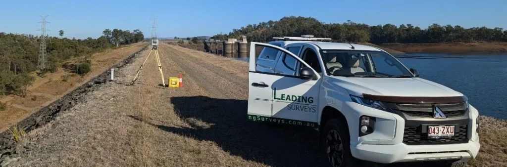
A Construction Survey from an experienced team eliminates this risk. Our surveyors use high-precision total stations, GNSS equipment, and in some cases, automated robotic setout systems (including the HP SitePrint robotic layout solution) to deliver setout data that builders and contractors can rely on without question.
Stage 4: Monitoring, Quality Assurance and Volume Verification
Construction doesn’t happen in a straight line. Conditions change, designs evolve, and works need to be checked and verified as they progress. This is where ongoing surveying support adds enormous value to a project.
Subsidence and deformation monitoring tracks whether structures, embankments or existing buildings adjacent to active works are moving in ways they shouldn’t be. For deep excavations, retaining walls, underpinning works or large earthfill operations, this monitoring can be the early warning system that prevents a small movement from becoming a major structural event.
Quantity verification and volume monitoring support accurate payment claims. On bulk earthworks projects, for example, earthmoving contractors are typically paid based on measured volumes, the amount of material cut, filled or removed. Surveyed volume calculations give both the client and the contractor a defensible, accurate basis for payment. Without independent verification, disputes are common and expensive.
Stage 5: As-Constructed Documentation
When the construction is complete, the project needs to be documented as it was actually built. As-constructed surveys capture the final positions and dimensions of all constructed elements, buildings, infrastructure, services, drainage, paving, and more, and produce the formal records that local councils, utilities and certifiers require for sign-off.
This is not optional paperwork. Local governments and certifying authorities typically require as-constructed documentation before they’ll grant compliance certificates or accept infrastructure for dedication. Getting this done properly by a registered surveyor ensures there are no delays at the critical handover stage of a project.
Leading Surveys provides ADAC (Asset Data and Asset Configuration) surveys alongside standard as-constructed documentation, giving project teams the complete records they need to close out a project cleanly.

How Surveying Supports Different Types of Construction Projects
Residential Subdivisions
For a residential Subdivision Survey, surveying involvement starts with the initial boundary definition and lot layout, runs through the civil infrastructure construction (roads, drainage, services), and ends with the formal survey plan lodgement and title creation for each new lot. Every stage requires precise, registered survey work carried out by a licensed cadastral surveyor.
Commercial and Industrial Developments
On commercial and industrial sites, the stakes are high and the tolerances are tight. Column grid setout, slab levels, service corridors, loading dock geometry, all of it needs to be right the first time. Regular surveying checks during construction catch errors early, when they’re still cheap to fix.
Civil Infrastructure
Road upgrades, bridge works, pipeline corridors and drainage systems all depend on accurate survey setout and quality assurance monitoring throughout construction. Civil contractors working in the Queensland market rely on surveyors to keep machines on alignment, grade and profile.
The Cost of Getting It Wrong
Here’s the uncomfortable truth: surveying is a small line item in most construction budgets, but the cost of survey errors can be enormous. Structural rework. Boundary encroachments. Failed compliance inspections. Disputes over what was built versus what was approved. Delays to settlement or handover.
Every one of those problems costs significantly more to fix than the survey that would have prevented them. The best construction teams treat their surveyor as a key part of the project team, someone involved early, consulted regularly, and relied upon for independent, accurate data throughout.
If you’re looking for experienced land surveyors who understand the demands of construction projects in Queensland and across Australia, the team at Leading Surveys is ready to help. We work with builders, civil contractors, developers, architects and engineers who expect accuracy, responsiveness and practical advice, not just data dumps.
A construction surveyor does far more than mark out where walls go. From the first site visit to the final as-constructed certification, surveying touches every critical decision point in a project. The right surveying team brings accuracy, confidence and compliance to a project. The wrong approach, rushing the setout, skipping verification checks, or leaving as-constructed documentation to the last minute, creates problems that are far more expensive to resolve than the survey work itself.
At Leading Surveys, our team is structured to support construction projects of all types and scales across Queensland and Australia. Find out more on our About Us page or reach out to us directly via our Contact Us page to discuss your project requirements.