The development application went in on a Thursday. Six weeks later it came back with an information request that could have been avoided with one site visit.
The architect had used levels off a contour plan that predated a kerb rebuild in inner Brisbane. Two trees shown as remaining were already gone. Once we measured the block properly, the proposed slab sat under the flood planning level. Nobody had ordered a current Detail Survey. Council did not need to be unkind about it. The drawings were simply wrong.
We hear the same question most weeks at Leading Surveys. Can this job run on the last survey, or does someone have to get out there again? Developers ask it because they are watching cash. Builders ask it because the program is already tight. Architects ask it because they have already started drawing.
Here is the unromantic answer. If the next decision depends on the land as it is this month, you need a current pickup. South East Queensland sites change. Streets get reconstructed. Neighbours build walls. Fill appears that was never on the sales plan. Council will not accept a tidy PDF that no longer matches the gutter.
What we are measuring on the ground
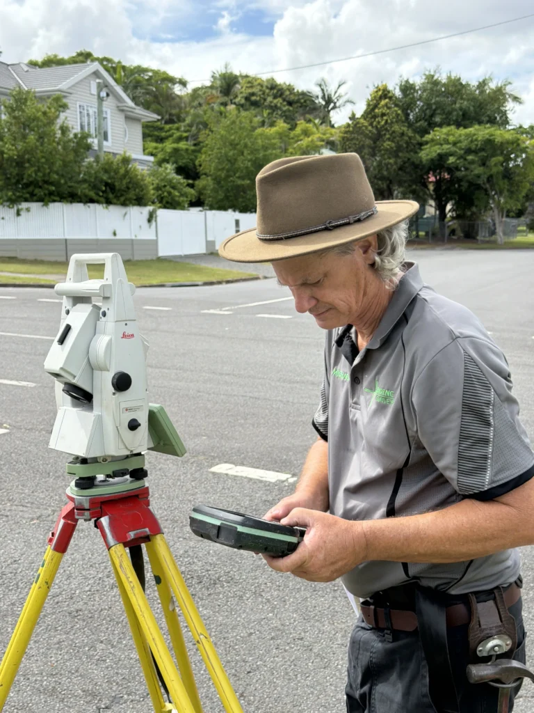
A detail survey is not a title search and it is not a design. It is a measured picture of the place as it sits. Dirt, buildings, trees, lids you can see, and the heights that decide where water goes.
On a normal Queensland allotment that usually means spot levels and contours on AHD, the house and the sheds, retaining, fences, paving, driveways, kerb, channel, footpath, road crown, pits, hydrants, poles, stormwater outlets, overland flow, easements once they have been plotted, and neighbouring floors or eaves if the setbacks are going to be tight. Trees as well, if the arborist or the overlay is going to care.
People mix up the language. Feature survey. Topographic survey. Contour Survey. Contours with no features leave the architect inventing trees. Features with no reliable levels leave the civil engineer inventing a surface. We put them on the same plan, same model, same control. One job.
We have done that on a Paddington house lot you could almost spit across, and on broad acre sites that take a full day just to walk. Method changes. Total station, GNSS, scanner, UAV. The point of the work does not.
Council wording changes. The expectation does not.
Brisbane City Council writes the checklist one way. Gold Coast another. Moreton Bay, Sunshine Coast, Logan, Ipswich, all slightly different. Underneath it is the same habit. Change the levels, the drainage, the setbacks, the earthworks or the relationship to a neighbour, and they want measured features and contours under the drawings. Traces off Nearmap do not get you there. Neither does a kerb line someone sketched because they “know the street”.
You are lodging a DA
Material Change of Use. Reconfiguring a Lot. Operational Works. A planner can write a sharp report and still cop an information request if the site plan is sitting on heights that are wrong. Flood, landslide, bushfire, vegetation. Those overlays care about real ground. A 2018 contour under a 2026 overlay map is how those letters get written.
You are cutting lots or joining them
A Subdivision Survey is about title. It will not tell the civil designer where the existing kerb is, how vicious the fall is through the back, or whether the new driveway can meet the road at a grade anyone will approve. Title makes the lots. Detail makes the engineering sit down. You want both.
New house, dual occ, extension
Builders get caught here more than they admit. The old plan has a floor level. It does not have last year’s footpath reconstruction, or the neighbour’s new retaining, or the tree the arborist has now decided is staying. Then the first slab setout turns into a standoff. The clash was always on the ground. It just was not on the drawing.
Cut, fill, walls, drains
Earthworks quantities are only as honest as the existing surface. Thin survey, thin truck count, wrong wall height, ugly claim. We have sat in enough of those arguments to know where they start. Usually a contour that was never dense enough through the gully.
Overlay land, creeks, flood maps
Flood planning levels in SEQ do not shrug. If the habitable floor is chasing a defined level, the survey has to be on AHD and the connection has to be real. A hundred and fifty millimetres out on a riverside lot in New Farm is not a rounding issue. It is a redesign. Then a delayed certifier. Then a quiet conversation with whoever is funding it.
Services, easements, neighbours hard against the works
Basement. Zero lot line wall. Service relocation. You cannot design that off an aerial. If the easement only lives as a note on title, it is not real for the designer until it is plotted against the driveway everyone thought they had room for.
And if you are buying the site, get the survey before you congratulate yourself on the purchase price. Marketing plans are flatter than the land. Always.
“Just send a surveyor” is not a brief
Three different jobs hide under that sentence.
A Boundary Survey or Identification Survey answers a legal question. Where is the title. Is the fence on it. Does the building stick over. Cadastral work. Registered cadastral surveyor. Anything close to a line leans on this.
Detail and contour answer a design question. What is on the land, and how high.
Most development jobs need both. We often reinstate the boundary and pick up features in the same visit so the architect is drawing to a line that exists in the ground. GIS can be 400 millimetres off and still look convincing on a laptop. Design a 1.5 metre setback off the wrong line and you get an encroachment. Then someone wants a Form 16 and there is no clean way through.
After the approval, a Construction Survey and Set Out Survey take the same control into the field. Pegs, grids, reduced levels, hold points. If the detail survey was done properly, the setout crew is not inventing a coordinate system on Monday while the excavator idles.
Surveys do not expire. Sites do.
There is no Queensland stamp that says a plan dies after two years. Councils and certifiers still treat old data as a risk, and they are right.
Under 12 months and the site has not been touched: we will often work with it.
12 to 24 months: go and look. Neighbour built? Street reconstructed? Trees gone? Update it.
Over 24 months and you are lodging: budget a new pickup.
Any age, if someone has cut, filled, demolished or shifted services: stop calling it current.
We have been handed surveys from three years ago that looked perfectly professional and had missed a new pad, a relocated sewer manhole, and a 600 millimetre change in footpath level after a road upgrade. The linen was fine. The street had moved.
A development application survey is more than a few contours
If all you get is a house outline and some 0.5 metre lines, push back.
You want a named AHD benchmark, not “assumed reduced level 10”. You want MGA, or a local system that is documented, with marks later setout can occupy. You want a note that says whether the boundary was reinstated or only plotted from title. Those two notes are not cousins. The second one is dangerous if you are building close.
A steep Brisbane ridge is not an Ipswich industrial pad. If the surface will drive earthworks quantities, say so when you ring us. We will pick up more. Visible lids are not a full service locate. Planning a basement in Fortitude Valley? The feature survey is the start of that conversation, not the end of it.
Trees need to be in a form the arborist and council can use. Species, trunk, spread, spot at the base. Pulling them off an aerial is how a significant tree gets “missed” and then holds up operational works while everyone pretends to be surprised.
Give the planner a PDF. Give the engineer a DWG or a 12d or Civil 3D surface. Give us a reason to scan if the site is tight, vertical or full of plant. Road corridors are the obvious case for UAV and scanning. Most of a carriageway can be picked up now without standing in the lane. That is not for the brochure. That is so people are not standing on asphalt with a prism.
Searching for land surveyors Brisbane, or a contour surveyor for a DA, ask the useful question. Will the designer get a surface, a boundary relationship and a service picture that survives council and then survives construction? Drawing contours is the easy bit.
The jobs that keep making the same point
Inner city dual occupancy. Tiny lot. Fall out the back. Neighbour windows a few metres off the boundary. The architect needs existing floors, eaves, and a true line. Without the survey, the overshadowing diagrams are theatre.
Industrial shed on a pad that “looks flat”. It is not. Four hundred millimetres of fall and a swale that never made the sales plan. One pickup. Drainage redesign avoided.
Civil contractor pricing bulk earthworks off a 2019 contour. Vegetation gone, surface stripped, model wrong. New pickup before the claim period. Cheaper than the argument, every time.
Townhouses, easement nobody put in the briefing email. It is on title. It only becomes real when it is plotted against the buildings and the driveway.
Gold Coast flood lot. Habitable floor locked. The certifier will take the surveyor’s AHD connection. They will not take a phone.
None of this is rare. These are the calls that come into Contact Us after the money has already been spent. Have the conversation before lodgement. It is a shorter conversation.
Ten minutes on the phone beats a thin plan
“Levels and features please” is how you get a drawing that looks complete and still misses the thing your engineer needed.
Say what the project is. House, MCU, ROL, civil package, as-constructed. Which council. Which overlays you already know about. Whether the boundary must be marked or only plotted. Whether trees need numbers. How far past the fence you care about: adjoining roofs, opposite kerb, the downstream pit. What the engineer models in. Whether you need underground locating or just the lids. And the lodgement date. A DA in three weeks is not the same field week as a feasibility sketch.
We talk to project managers and foremen, not only the people in the office. If someone on the architect’s team thinks a spot level looks odd, the surveyor on the job should be callable. That is the working arrangement. The About Us page mentions collective experience, which is true enough. The bit that matters on a live job is that cadastral, contour and construction people look at the same file before it goes out.
You will see the survey fee. You will not see the other one until it lands.
Redesign after an information request. Retaining that needed another 400 millimetres. Driveway that cannot meet the road. Unit that has to shuffle for a tree. Setout that does not match the boundary. Flood level taken off the wrong datum.
On a modest residential job those already cost more than the survey. On a commercial or industrial site they cost a lot more. The developers who treat the first survey as optional are usually the ones who later want an approved design forced onto land it was never measured against.
Order a detail survey when the next decision needs the land, not the brochure. In Queensland that is most development work. DA, subdivision design, new dwellings, earthworks, drainage, overlay sites, anything sitting close to a boundary.
Get the cadastral position right. Get the contours and features right. Carry the same control into construction. If you are planning work in Brisbane, or on a site we can get to elsewhere in Australia, talk to us before the first sketch hardens into “the design”.
Contact Us with the address, the council and what you are lodging. We will tell you if you need a feature pickup, a cadastral mark-up, or both. Sometimes the honest answer is both, and it is better to hear that on a Tuesday than from council in week six.